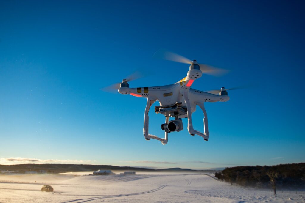
With the advent of digital technology, our ability to gain a perspective of the Earth has drastically improved, opening us to new opportunities to study the planet’s dynamic behavior in areas like geology. Unmanned aircraft systems, also known as remotely piloted aircraft, unmanned aerial vehicles, or, more commonly, drones, are the most recent innovation for photographing and sampling the surface of the Earth.
There are many different platforms, sizes, and shapes for drones. These come in a variety of designs (single rotor, multirotor, hybrid, and fixed-wing platforms), and they can be used to transport a wide range of payloads, such as sensors, cameras, and sampling gear. More significantly, drones are currently used for a variety of assessments of dynamic processes in two, three, and four dimensions, changing our capacity to quickly gather high-quality observations over the surface of the Earth.
The geosciences community as a whole has taken to the skies, with a wide range of researchers deploying a variety of drone platforms, sensors, or samplers in various distinctive and creative applications. Drones will soon be utilized for purposes other than Earth surface imaging thanks to the development of drones and new sensor technologies. This creates a myriad of new opportunities for Earth science research.
Geosciences literature reveals that drones are currently being actively used for a variety of goals and in a wide range of sectors. The ability to carry payloads of sensors and sampling gear capable of gathering an astounding array of photos, physical samples and synoptic measurements makes the most recent generation of drones particularly adaptable.
Ways Drones Open Up New Frontiers in Geology
1. Drones help geologists define topography.
Drones have been a growing part of the structure from motion (SfM) photogrammetry technique in recent years, which converts 2-D photos into 3-D topographic surfaces. High-resolution topographic imaging is produced by this method, which can be used to identify microtopographic features like tiny water channels on a glacier’s surface and to supplement already-existing topographic data.
2. Drones help geologists evaluate dangerous or inaccessible locations.
Drones are especially helpful for taking images or measurements above places that are dangerous or challenging to get on foot. In a pioneering instance in 2008, Italian geologists measured volcanic gases in the La Fossa crater of Vulcano volcano in the Tyrrhenian Sea, using a quadcopter equipped with spectrometers and electrochemical sensors. The study established a standard for the use of quadcopters in volcanology, setting the bar for how well they can forecast eruptions and quantify carbon dioxide flux. [1]
In 2016, another illustration is the use of octocopters to track methane (CH4) dynamics above and below the trade wind inversion on Ascension Island in the South Atlantic Ocean, a prime location for assessing tropical background methane concentrations. Up to 2,700 meters above mean sea level, where the octocopters flew, they sampled methane while operating at high heights. The scientists then used the air chemistries they had observed to identify chemical signatures that point to different heights’ sources of air masses. The study finally showed that monitoring the atmosphere with drones can uncover spatial intricacies (such as the air column) that are frequently ignored by sampling at the surface. [2]
3. Drones help geologists capture passing occurrences.
Nutrient blooms, sediment plumes, and floods are a few examples of ecological and landscape reactions that may only last a short while, and drones are excellent for mapping these. In the St. Denis National Wildlife Area in Saskatchewan, Canada, geologists used drones to identify an intermittent stream network. Additionally, the researchers discovered that the performance of drone delineation of intermittent, narrow streams consistently beat that of multispectral SPOT-5 satellite images (10-meter resolution). Training SPOT-5 delineation on drone footage had no positive effects on classification accuracy, indicating that high-resolution drone photography may be one of the few instruments capable of continuously obtaining images of fluvial processes at relatively small scales. [3]
4. Drones help geologists put satellite and ground-based imagery into context.
Comparisons between data from drones and satellite photography provide a mechanism to reconcile data gathered at various geographic scales in light of the expansion of satellite data products
5. Drone imagery helps geologists confirm the accuracy of computer simulations.
In numerous areas spanning the geosciences, data from drones have also been utilized to limit model inputs or to compare data to model simulations. The spatial modeling of stratigraphy is one expanding use (the sequencing of rock layers in a formation). Two recent studies have shown that drones have the potential to revolutionize evaluations of spatial patterns of Earth processes.
6. The world is better because of drone
The drone revolution is spreading beyond the field of study to several regular humanitarian and environmental applications all around the world. Swarms of commercial drones are being used by DroneSeed, a firm based in Seattle, Washington, to spray herbicides on invasive plants. The startup wants to employ drones to find the best microhabitat locations for growing trees, distribute biodegradable seedpods, and safeguard tree development by preventing the spread of invasive species. With a small fraction of the workforce needed to complete the same task on foot, they aim to replant substantial expanses of difficult terrain. [4]
The future of drones in Geosciences
Drone use in geosciences offers a variety of innovative and exciting opportunities that could improve field investigation efficiency, accuracy, and detail while also enhancing field geologist safety.
With the prospective usage of swarming autonomous microdrones that could be launched with the mission essentially pre-programmed before being left to determine on their own the most effective way to complete the programmed assignment, the near future presents even more intriguing possibilities.
Imagine arriving at your field site early in the morning, setting up your “birds” for flight, and then releasing them into the sky to investigate the pre-programmed area. Later in the day, they independently return to the field site with all necessary data gathered and prepared for processing and evaluation.
References
[1] https://earth-planets-space.springeropen.com/articles/10.1186/s40623-016-0418-0
[2] https://agupubs.onlinelibrary.wiley.com/doi/full/10.1002/2016GL071155
[3] https://eos.org/features/drones-in-geoscience-research-the-sky-is-the-only-limit
[4] https://www.beavertonvalleytimes.com/news/droneseed-aims-to-land-in-billion-dollar-marketplace/article_eb31992e-b016-5a28-8877-da044d49220f.html
