
Table of Contents
Drone Terminology
Before discussing this field further, you must be familiar with all the standard terms used when talking about drones. For your convenience, we have categorized the terms in alphabetical order so you can easily search for a specific term.
A
Autonomous Flight
Some drones are not controlled by humans, which means they are internally programmed to tell them where to fly. For instance, a UAV may use its built-in GPS to fly from one point to another. The use of built-in GPS is known as autonomous flight.
Above Elevation Data (AED)
AED is defined as the altitude approximately above the ground.
Above Ground Level (AGL)
AGL is the altitude of a drone’s flight height.
Above the Takeoff Altitude (ATO)
ATO is the altitude where a drone started its motors before takeoff.
Axis
A plane of potential flight. Typically, most quadcopter drones have four-axis controls, with 6+ being preferred.
Autopilot
The capability of a UAV to conduct a flight without a pilot aboard.
B
Background Map
A background map is a 2D map that consists of landforms, roads, etc. It is then layered with additional data, also referred to as a base map.
Base Map
The base map consists of additional data to a background map.
Beyond Visual Line of Sight (BVLOS)
BVLOS is an operating method in which a UAV is flown right beyond the operator’s line of sight.
Brushless Motor
They are equipped with permanent magnets that rotate around a fixed armature[i]. Brushless motors are much more efficient and durable than brushed motors.
C
Check Point
A check point is a surveyed point on the ground that verifies the accuracy of photogrammetric outputs.
Ceiling height
The maximum adjustable vertical height that a UAV can fly to within the working area.
COAs
COA is an abbreviation for Certificates of Authorization. A COA is needed to fly UAVs domestically under existing rules[ii]. More than 100 certificates of authorization have been issued to several government agencies, universities, and companies.
Camera Gimbal
A camera holder in most aerial drones can tilt and swerve, all thanks to its servo motors. A high-quality gimbal eliminates shakes and jolts that can blur the footage.
Commercial Flight
Commercial flight is flying a drone for making money. Commercial flights are restricted by the FAA [iii]unless you have an RPC (Remote Pilot Certificate) with a small, unmanned aircraft rating.
D
Drone
Drone is a term used for an underwater or unmanned vehicle that doesn’t have an onboard pilot. In the beginning, this term was used to refer to large UAVs that the military used for surveillance, launching missiles, or dropping bombs. But nowadays, there is a wide variety – from commercial to hobby drones.
Digital Terrain Model (DTM)
DTM is a 3D display of data that features regularly spaced points and natural terrains.
Digital Surface Model (DSM)
DSM is a 3D display of an area featuring the tops of buildings, trees, vehicles, and other ground-based objects.
Digital Elevation Model (DEM)
A 3D display of bare earth in the form of a raster grid that doesn’t include any natural and artificial features.
E
Extended Visual Line of Sight (EVLOS)
An operating method in which the operator relies on remote observers to keep a UAV within the visual line of sight.
EIS
An abbreviation for Electronic Image Stabilization. A technology that reduces shakiness occurring during flight and ensures better video recording.
F
Flight Log
A flight logs is the record of a single flight taken by a drone.
Federal Aviation Administration (FAA)
FAA is a USA-based government organization that falls under the department of transportation. They focus on aviation regulations for both commercial and hobby drones.
First Person View (FPV)
A system in which the person flying the drone can view the footage from its camera in real-time.
FPV Racing
A sport in which remote pilots race their drones on a predetermined track.
G
Geotag
A geotag is an electronic tag of coordinates that are assigned to photos and videos via the process of geotagging.
Geographic Information System (GIS)
A system that allows users to visualize, question, analyze, and interpret data to understand spatial patterns, trends, and relationships.
Global Navigation Satellite System (GNSS)
GNSS is a satellite navigation system providing global coverage, such as GPS, the European Union’s Galileo system, and GLONASS.
GeoTIFF
It consists of public domain metadata that enables geo-referencing information to be embedded in a TIFF image file taken from a drone.
Global Positioning System (GPS)
The USA’s navigation system provides location and time information anywhere around the earth. It also offers global coverage and has high precision.
Globalnaya Navigazionnaya Sputnikovaya Sistema (GLONASS)
Russia’s version of GPS provides similar precision with global coverage.
Ground Control Point (GCP)
GCP is an object or location on the ground that has precisely known coordinates.
Ground Control Station (GCS)
Refers to a ground-based control center, such as a PC or laptop computer that controls UAV flights.
Ground Sampling Distance (GSD)
The distance measured between the two consecutive pixel centers on the ground. It is also known as ground resolution.
Geofencing
Creating a virtual geographic boundary using GPS technology is known as geofencing. The software will then trigger a response when a UAV enters or flies within that specific geofenced area.
H
Headless Mode
When activated, the drone will follow your stick movements regardless of its head or tail’s position.
Hobby Grade
The drones that fall under this category are better than toy-grade and offer good reliability and performance at a budget price.
I
Image Overlap
This refers to an intersection of various images. The more the images overlap, the better the output will be.
Index Map
An index map shows specific values for soil or vegetation, such as soil moisture or greenness.
Inertial Measurement Unit (IMU)
IMU is an electronic device that consists of sensors such as gyroscopes, accelerometers, and magnetometers. It detects changes in acceleration and rotation and is used to maneuver aircraft.
Infrared imagery
Images based on the heat energy of the infrared spectrum.
J
Jello
jello is the effect of undesired vibration in your footage caused during the flight when talking about drones. The jello effect can cause the video to appear distorted, like jello jiggling. It can be corrected using EIS or gimbal.
K
Kinetic Energy
The energy an object possess due to its speed or motion.
Keypoint
An identifiable point in an image is known as a keypoint.
L
LIDAR
LIDAR is the abbreviation of Light Detection and Ranging. It is a remote-sensing technology that measures the distance from one point to another with a targeting laser and then analyzing the reflected light. LIDAR is a common technology used in most surveillance drones[iv].
M
Magnetometer
A geophysical device that measures the strength of Earth’s Magnetic Field. It is also used alongside various sensors, such as gyroscopes and accelerometers to determine a UAV’s altitude.
Metadata
Metadata is a set of data that determines or points to other data. If we talk about a photo, its metadata may consist of information including where it was captured, when it was captured, who captured it, the camera used, and more[v].
N
Normalized Difference Vegetation Index (NDVI)
NDVI is a standard vegetation index used in precision agriculture. It provides information about the chlorophyll content in plants.
Nano
Nano is a tiny drone that can easily fit in the palm of your hand and fly indoors.
O
Orthophoto
An orthophoto is an aerial photo taken from a drone, aircraft, or a satellite where the effect of the central projection has been removed.
P
Parallax
The effect caused by an object’s location viewed from two different lines of sight or angles.
Photogrammetry
Photogrammetry is the science of recording, measuring, and interpreting photos via data retrieved about the environment and physical objects.
Payload
A product or components are carried by a drone or a UAV to fulfill a specific mission. In the case of a courier drone, the package to be delivered would be called a payload.
Pitch
A drone’s rotation in which its nose moves up or down about a transverse axis. In the case of fixed-wing drones, the axis runs from wing to wing.
Point Cloud
Points are typically defined by X, Y, and Z coordinates in a 3D coordinate system.
Post-processing kinematic (PPK)
PPK is a technique used to correct geotag locations once the drone data has been captured and uploaded. It is an alternative kinematic technique to RTK (Real-time Kinematic).
Prop
Short for Propeller.
R
Radio Link
Radio link indicates the quality of the wireless connection between the ground control station and the drone.
Rasters
Rasters are digital photographs captured by a drone.
Raster Data
A raster comprises a matrix of cells or pixels organized into rows and columns. Each pixel or cell contains a value representing a set of information, such as altitude, temperature, or the RGB value.
Real-Time Kinematic (RTK)
An alternative technique to PPK is used to enhance the precision of position data received from satellite-based positioning systems. It relies on an interpolated virtual station or a single reference station to provide real-time corrections.
Red Green Blue (RGB)
RGB is the region of the electromagnetic spectrum from 400-700 nanometers approximately.
Remotely Piloted Aircraft System (RPAS)
A configurable set of remotely piloted/controlled aircraft elements.
Revolutions Per Minute (RPM)
RPM describes the rotation speed per minute of a motor, wings, or any other machine.
Roll
A roll is a drone’s rotation about its longitudinal axis, running from the nose to its tail.
Return to Home
An intelligent feature in many drones returns the drone to the “home” (the position from where it took off). Read more about this feature below.
Rx
Abbreviation for Receiver.
S
sUAS
sUAS is an abbreviation for Small Unmanned Aerial Vehicle. This term usually refers to a compact battery-powered drone that one or two people can pick.
Spotter
A spotter is any person who keeps an eye on a drone while you fly it via First Person View (FPV). They can alert you of the hazards which may be out of your field of view.
T
Temporary Flight Restriction (TFR)
The area determined by the FAA to be restricted temporarily is known as TFR.
Throttle
A control that increases or decreases the RPM or the speed of the drone.
TX
Abbreviation for a transmitter or transmit.
U
UAV, UAS
UAV and UAS are abbreviations for Unmanned Aerial Vehicle and Unmanned Aircraft System. These terms refer to flying objects that have no onboard pilots like traditional transport planes. UAVs are commonly known as drones.
V
Vector Data
Vector data is a representation of the earth using lines, polygons, and points, for example, X, Y, and Z coordinates.
Virtual Reference Station (VRS)
Networks that use RTK solutions to provide high precision and accurate RTK Global Navigation Satellite Systems.
Video Latency
Video latency is a lag in what your drone camera sees and when it transmits through the transmitter to your goggles or monitoring screen.
VRX
An abbreviation for video receiver.
VTX
An abbreviation for video transmitter.
W
Waypoint
A waypoint is a set of defined coordinates that define a specific point in the space.
Working Area
A dedicated area where the drone’s operating space and base station are located.
Y
Yaw
Yaw is the rotation of the quadcopter around its center axis on a level plane.
Basic Controls of Drones

Before flying your first drone, you must be familiar with all its basic controls to have a smooth flying experience.
1. Roll
A drone is rolled by pushing the right stick on the controller to the left or right. If you want to perform a stunt in the air or avoid hitting an obstacle, you can roll your drone and maneuver it left or right.
The mechanism behind it is when you push the stick to the left, the propellers will cause the air to the right, forcing the drone to steer to the left. Similarly, when you push the stick to the right, the propellers will face the left, forcing the drone to fly to the right.
2. Pitch
Pitch is accomplished by pushing the right stick on the controller forward or backward. This movement will tilt the drone, resulting in a forward or backward direction.
3. Yaw
You yaw a drone by pushing the left stick on the controller to the left or right. Doing this will rotate the drone left or right. It helps change the directions of your drone while flying.
4. Throttle
To increase the throttle, you have to push the left stick forward. To decrease it, move the left stick backward. Throttling engages the motor to adjust the height and altitude of your quadcopter.
5. Trim
There are buttons on the remote controller that let you adjust pitch, roll, yaw, and throttle if they seem a bit off-balance to you.
6. The Rudder
You may have heard the term rudder in the field of aviation, but it does not mean the same when used about drones. The term refers to the left stick on the controller, which controls the yaw.
7. Aileron
A term used for the right stick that refers to controlling roll (left or right direction of the drone).
8. The Elevator
This term is used for right stick, but it refers to controlling pitch (forward and backward direction of the drone).
When you are learning to fly a quadcopter, these controls will become your bread and butter. Once you know they work and interact together, you will have a smooth flying experience. If you push the stick harder, the stronger the movement will be.
When you start with drones, make sure to push the sticks very gently, so the drone performs slight movements. Once you get ahold of all the controls and how each of them works, you can make sharper movements.
Parts of Drones
Getting familiar with the parts of drones is also essential if you are learning how to fly them. If something goes wrong, you will be able to diagnose the problem and fix it by yourself. You also want to understand how each part works and its importance in completing the drone’s functionality. These are also the key components to building your drone.
1. The Frame
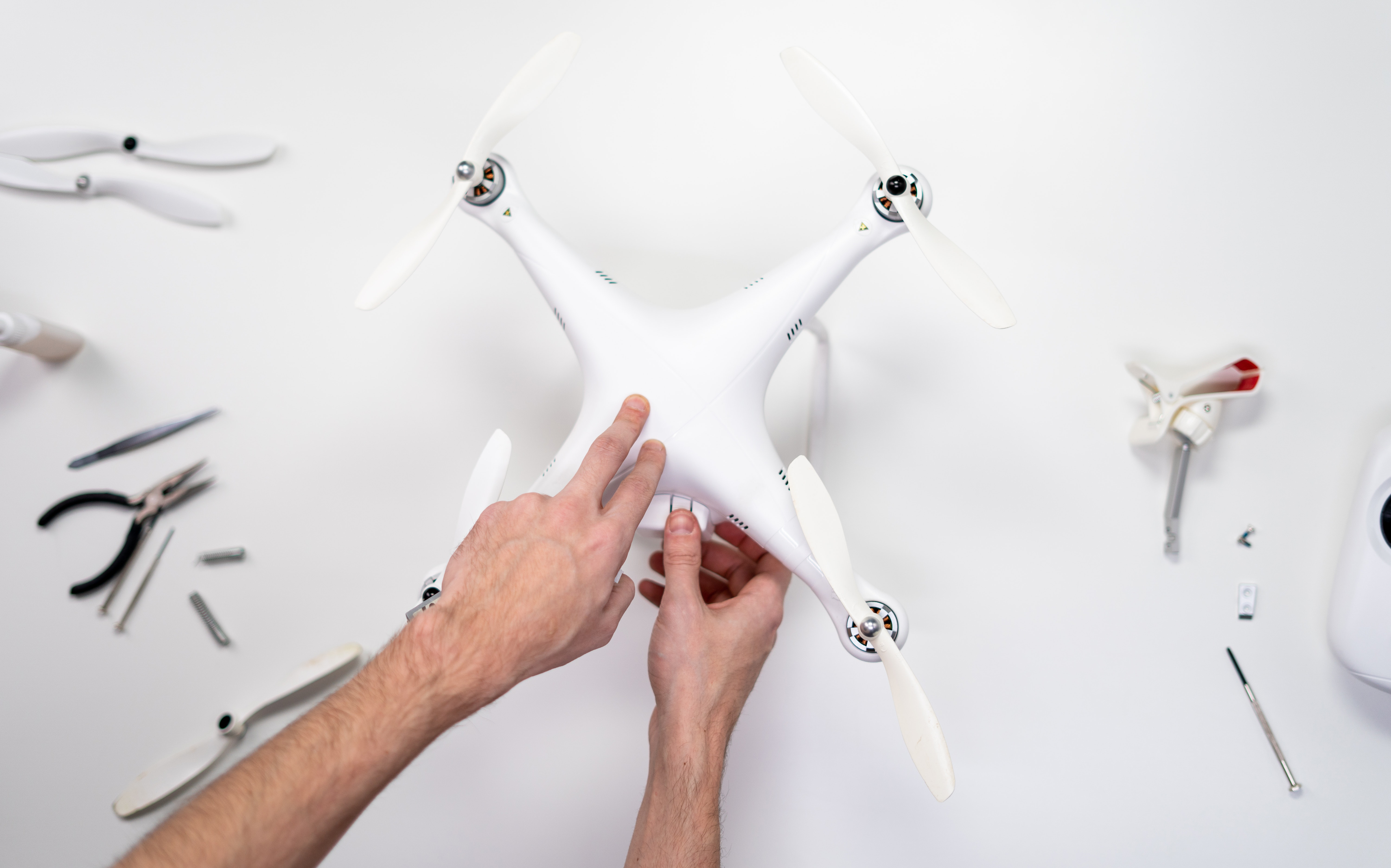
The frame is one of the most critical parts that make up a drone. It connects all the components in a way that they can efficiently work together. In the case of a drone, the frame is in the shape of an ‘X’ or a ‘+.’
If you plan to build a drone, you should consider the weight and the frame size and how it will affect your overall flying experience.
2. The Motors

The motors to the drone are what an engine is to a car. Without motors, a drone can never fly. A quadcopter, for example, needs at least four motors to fly efficiently as each motor powers a single propeller.
The stronger the motor (higher KV), the faster the motor will spin. Hence, the drone will perform better and have a higher speed. KV is often quoted in RPM per volt, which means if the motor is of 1,500 KV working on a 10V power supply, it will rotate under 15,000 RPM with no payload attached.
If you plan to build a drone, then choosing the right type of motor is essential for the better efficiency of your drone. You have to consider various parameters, such as thrust and thrust to weight ratio, efficiency and speed, voltage and current, etc.
3. Electronic Speed Control (ESC)
 | My Hobby Life")
These are the wired components of a drone that connect the battery to the motors. They send a signal to the motors that tell them how fast to work. At a time, the four motors of a drone can be working at different speeds. ESC is what allows the drone to change direction and move where you want to move it.
The Electronic Speed Controller does all this maneuvering and controlling.
4. Flight Control Board
This flight control board is the part that commands what operation to perform. It controls the gyroscopes and accelerometers, which control how fast each motor should spin under a specific situation.
Moreover, the flight control board also makes a log of the takeoff point if it wants to return to its takeoff place without being guided. This log comes in handy when you select the option “Return to Home.”
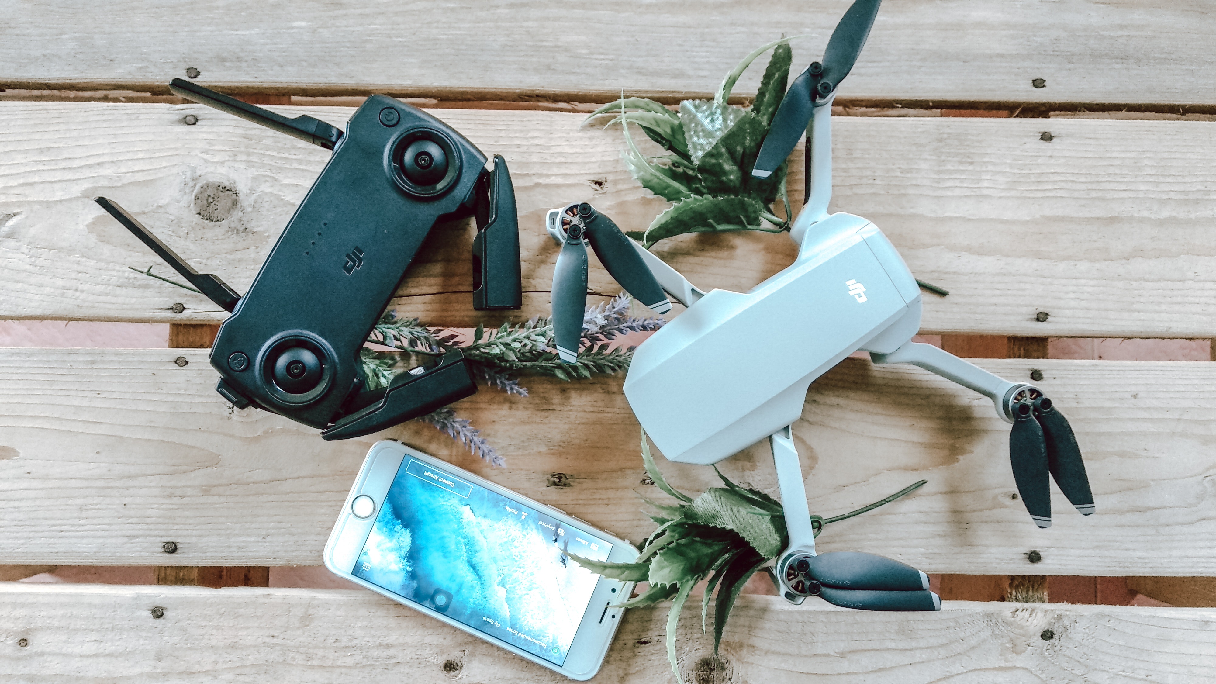
5. Radio Transmitter
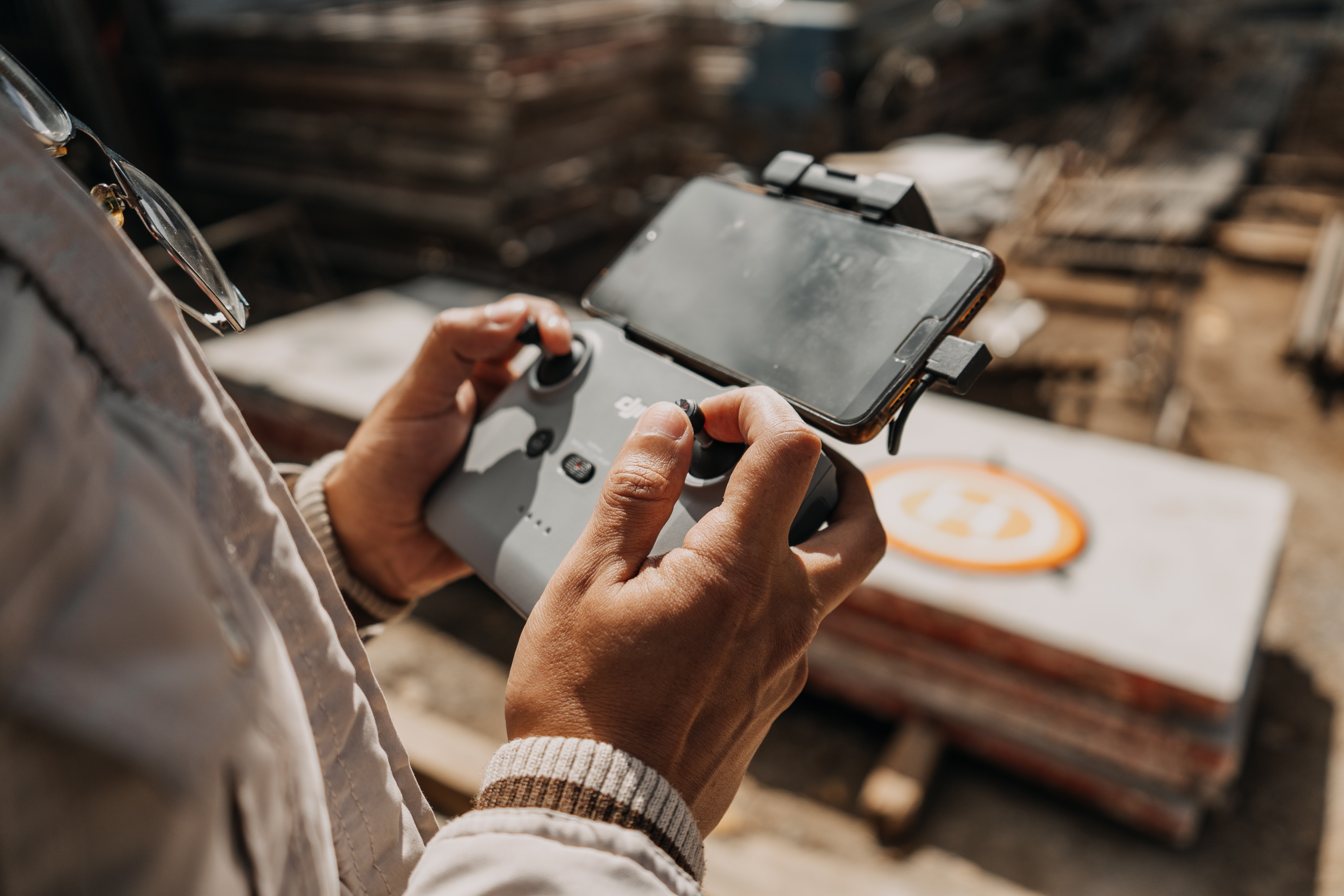
A radio transmitter (RX), also known as the remote controller, controls your drone. It communicates with the onboard receiver on the drone and guides it on what operation to perform. When you do something on the transmitter, the receiver understands that signal and sends it to the quadcopter system to complete that specific action.
For example, you push the right stick on the controller to the left to roll the drone. Within no time, the receiver gets this signal and asks the drone to perform this action. All of this happens in milliseconds, so that you can get an optimum flying experience.
6. Propellers
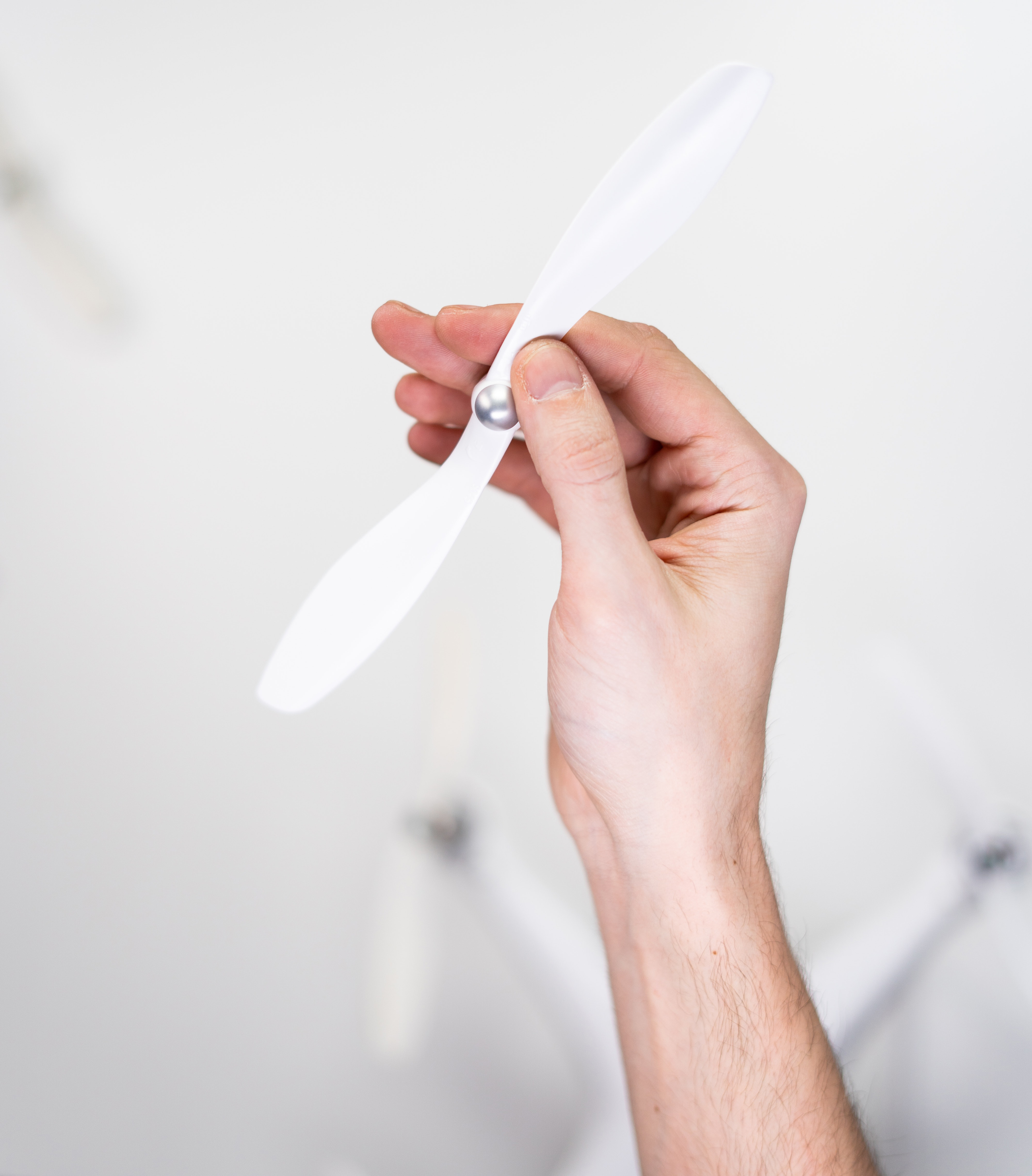
Propellers are blades structured to provide a difference in air pressure. A quadcopter has at least four propellers (some even have more). Each propeller helps determine which direction the drone flies or hovers in place. When rolling or yawing a drone, the propellers are in action and controlling the actual movement.
They cut through the air creating a difference in air pressure between the top and bottom of a drone. Higher air pressure is created under the drone, while lower air pressure is created above it. This difference allows the drone to achieve liftoff and fly. These propellers come in different materials, ranging from expensive (such as carbon fiber) to cheap (such as plastic)[vi]. The ones made of carbon fiber may be costly, but they are lightweight and durable – the qualities that cheap propellers don’t have.
7. Battery, Electronics, and Power Distribution Cables
The battery powers up a drone and supplies energy to all the electronic components in the framework; it does so through power distribution cables.
Be sure the battery is always charged to get an optimum flying experience. Most hobby drones have batteries, but when it comes to commercial drones, they may be powered via a gas or petrol engine, depending on their usage and applications.
Older drones used Nickel Metal Hybrid or Nickel Cadmium-based batteries[vii]. However, these batteries are almost obsolete in drones as lithium batteries replace them. These batteries can store more energy compared to their predecessors.
8. The Charger
A hobby drone that is powered through batteries needs a charger to get recharged. Therefore, you must always keep the charger in your drone bag because most hobby drones don’t have a long battery life, and they give up anytime.
9. Camera

Drones may or may not have cameras attached to them, depending on the type and your needs or wants. A hobby drone for aerial photography or videography is equipped with a camera and a gimbal to take well-balanced and sharp photos.
Some drones use onboard cameras, while others have GoPro cameras attached for higher quality and performance.
10. First Person View
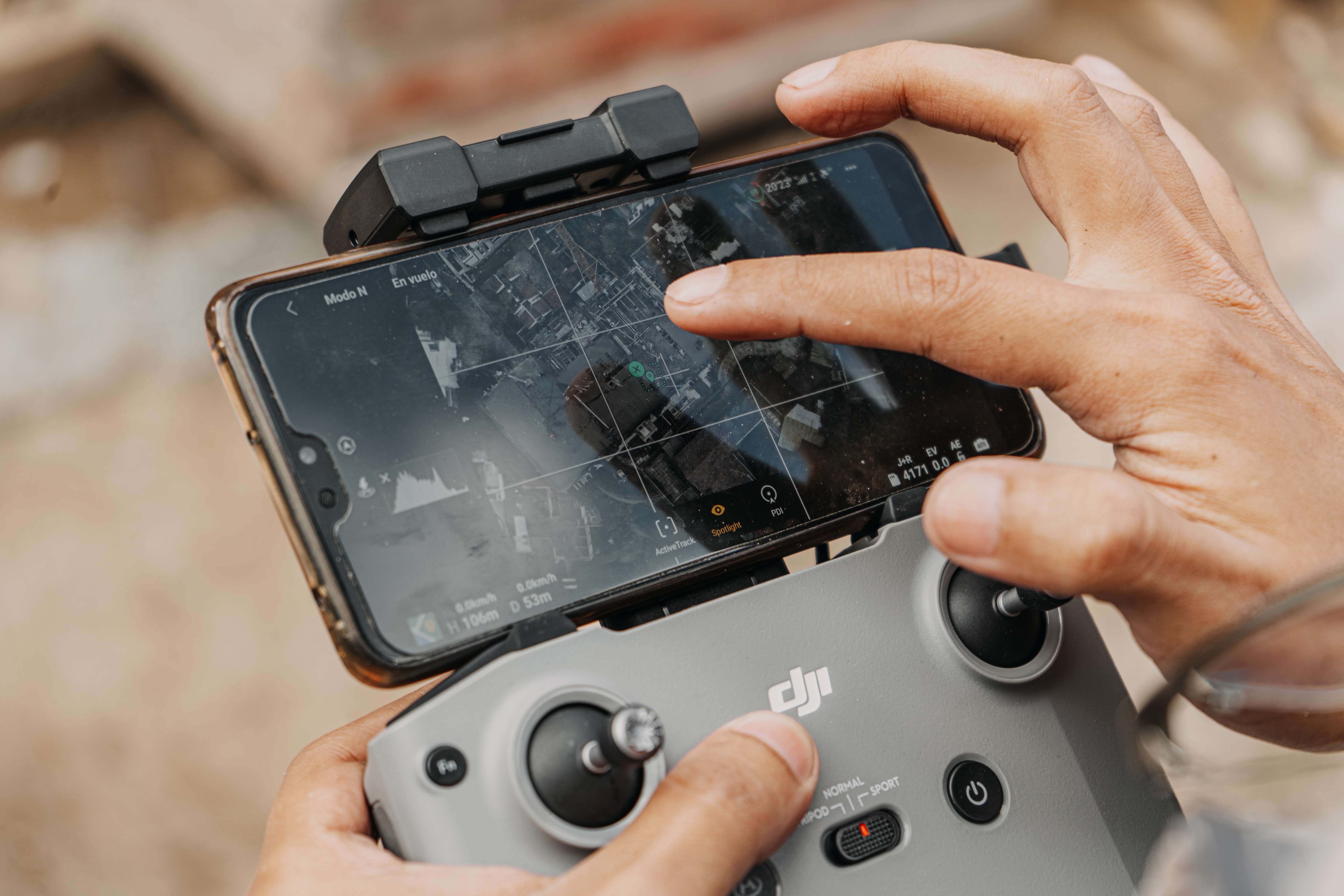
Not all camera drones offer this feature, but if you want more control and a greater viewing experience, First Person View (FPV) is excellent. Unlike a standard transmitter’s screen, FPV gives the user a 3D view experience and an ultimate feeling as if they are flying.
An FPV system consists of two major components; the first is called a ground component, also known as the ground station, and the other component is the video receiver. The ground station features a video receiver and a display screen. The video receiver receives the data by matching its frequency with the drone’s transmitter.
The most common frequencies for video transmission include 900MHz, 1.2 GHz, 2.4 GHz, and 5.8 GHz[viii]. Some ground components may even have high-quality antennas that result in greater image resolution.
However, it is up to you how advanced you want your FPV system to be. Some systems also have GPS navigation, flight data, and “return home” systems. Therefore, choosing the right set of components according to your requirements will allow you to get more benefits from your drone.
Important Things to Remember Before Flying a Drone
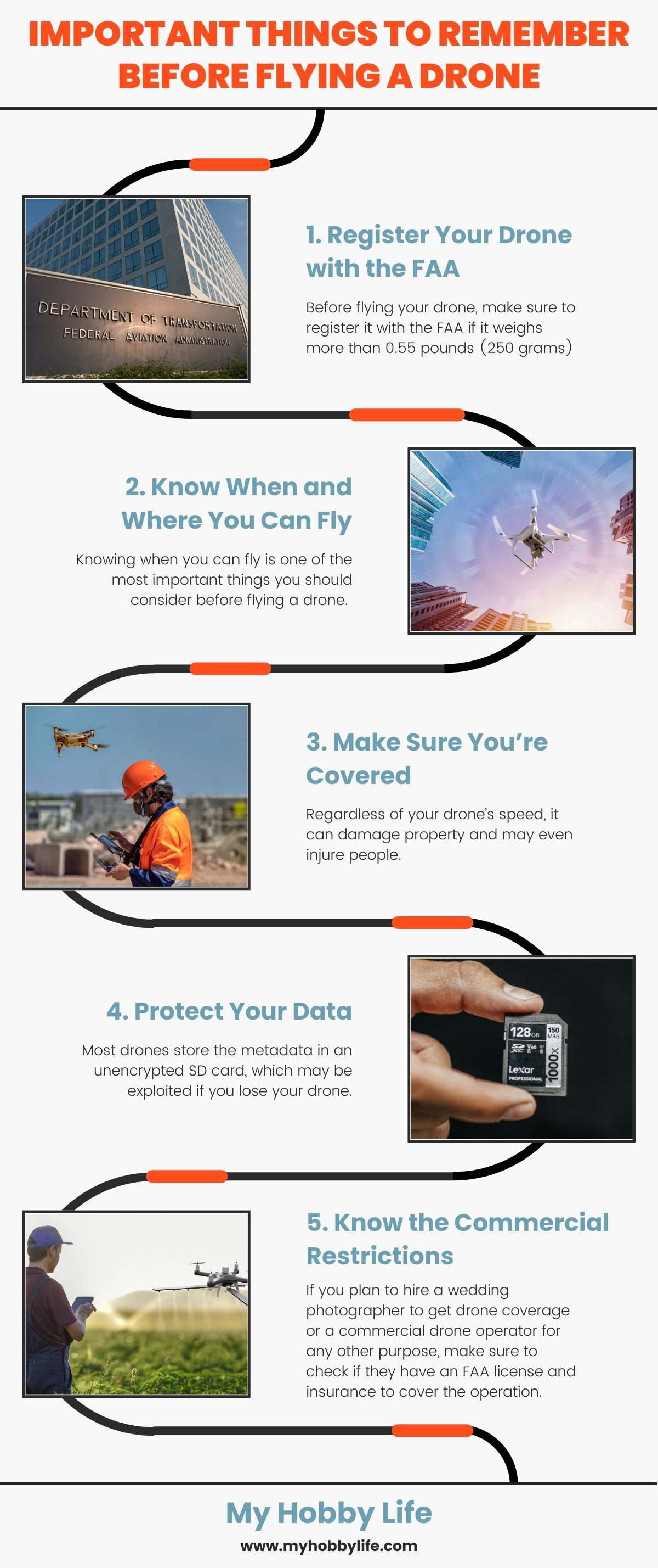
1. Register Your Drone with the FAA

Before flying your drone, make sure to register it with the FAA if it weighs more than 0.55 pounds (250 grams)[ix]. Even if it is a hobby-grade drone that you are flying for fun, registration is essential for a drone this size. In addition, you also have to label your drone with the registration number provided by the FAA and contact information. This way, you can easily recover your drone if you lose it.
2. Know When and Where You Can Fly
Knowing when you can fly is one of the most important things you should consider before flying a drone. Maintain a visual line of sight, so it doesn’t hit any obstacle or cause any serious damage to someone’s property. Operate a drone only in good weather conditions and during daylight hours. If you are planning to fly near an airport, it cannot be flown within five miles of any section of it unless you have previously notified the airport and airport traffic control.
Supposed you are unaware of the restricted areas. In that case, you can use the FAA’s B4UFLY mobile application with all the restrictions in the specific area you want to fly.
3. Make Sure You’re Covered
Regardless of your drone’s speed, it can damage property and may even injure people. Before operating your drone, make sure you are covered. The FAA requires you to report the damage/accidents worth more than $500[x].
4. Protect Your Data
Most drones store the metadata in an unencrypted SD card, which may be exploited if you lose your drone. The metadata of photos taken by the drone also includes the latitude and longitude. Many drone operators take photos of their homes, themselves, and other interests, which means that a lost drone could have information that can give away your location or any personal info you are unwilling to disclose.
5. Know the Commercial Restrictions
If you plan to hire a wedding photographer to get drone coverage or a commercial drone operator for any other purpose, make sure to check if they have an FAA license and insurance to cover the operation. Moreover, the FAA also places a restriction of flying directly over people, which should be considered beforehand.
Rules and Regulations

Stay Below the Maximum Allowable Altitude
As a general rule, the FAA recommends flying below 400 feet AGL (Above Ground Level) to avoid any possible conflict with a manned aircraft, such as a helicopter or a commercial plane[xi]. However, this limit may vary from country to country. For example, the maximum allowed height in Canada is 90 meters or below. Hence, it is your responsibility to fly your drone within these limits[xii].
Maintain Visual Line of Sight
Maintaining a visual line of sight is a technical way to say that you should always keep your drone in plain sight (without any assistance) at all times. If you are using an FPV system, you should not solely rely on it or use vision-assisted devices, such as binoculars or telescopes.
Don’t Fly Over People
If you recently bought a new drone and were thinking of flying it over somewhere like a beach and capture some shots of people relaxing and having fun, unfortunately, you will have to take your drone somewhere else. Flying drones directly over people is strictly forbidden by drone laws.[xiii]. People can include an individual or a group of people not part of the flight crew.
Therefore, make sure to stay away from stadiums, hospitals, public events, schools, and community events where large groups of people may congregate.
Always follow the Community-Based Guidelines
Your town, city, or country may have specific regulations regarding flying UAVs. So, check them with your local authority before flying your drone. If the area you plan to fly it doesn’t have any guidelines or rules, you can then abide by the laws laid out by your country’s aviation authority, such as the FAA.
Don’t Fly After Dark
This rule is the simplest of all the rules – don’t fly after dark. Low visibility increases the chances of accidents occurring, accidents you likely could be held liable for, depending on their nature. According to civil twilight, dark is considered 30 minutes before sunrise and 30 minutes after sunset[xiv].
[i] Chengyuan He and Thomas Wu (27 May 2018), “Permanent Magnet Brushless DC Motor and Mechanical Structure Design for the Electric Impact Wrench System.” Retrieved from https://www.mdpi.com/1996-1073/11/6/1360/pdf
[ii] Unmanned Aircraft Systems (UAS). Retrieved from https://www.faa.gov/uas/
[iii] Prohibitions, Restrictions and Notices. Retrieved from https://www.faa.gov/air_traffic/publications/us_restrictions/
[iv] David Benowitz (September 19, 2019), “6 Ways LiDAR is Revolutionizing Mapping and Geospatial Data.” Retrieved from https://enterprise-insights.dji.com/blog/lidar-equipped-uavs
[v] Image metadata. Retrieved from https://whatis.techtarget.com/definition/image-metadata
[vi] Inside a Drone – Propellers (May 19, 2016). Retrieved from https://www.dji.com/newsroom/news/inside-a-drone-propellers
[vii] Ossian Keith (December 2017), “HOW DOES THAT WORK? – Drones.” Retrieved from https://www.ingenia.org.uk/Ingenia/Articles/6a9e3394-def0-441a-9229-c760bb39d26a
[viii] Craigi (November 17, 2014), “Basics of Radio Frequencies for FPV Quadcopter Drones.” Retrieved from https://www.droneflyers.com/basics-radio-frequencies-fpv-quadcopter-drones/
[ix] Evan Ackerman (January 19, 2021), “New FAA Drone Rules: What Recreational and Commercial Pilots Need to Know.” Retrieved from https://spectrum.ieee.org/automaton/robotics/drones/faa-drone-rules-what-recreational-and-commercial-pilots-need-to-know
[x] Rumberger|Kirk (April 19, 2017), “Understanding FAA & NTSB Drone Accident Reporting Requirements.” Retrieved from https://www.jdsupra.com/legalnews/your-business-drone-crashed-what-do-you-88892
[xi] ENR 5.7 Potential Flight Hazards. Retrieved from https://www.faa.gov/air_traffic/publications/atpubs/aip_html/part2_enr_section_5.7.html
[xii] Regulation of Drones: Canada. Retrieved from https://www.loc.gov/law/help/regulation-of-drones/canada.php#:~:text=The%20guidelines%20also%20state%20that,buildings%2C%20structures%2C%20or%20vehicles.
[xiii] Operations over People General Overview. Retrieved from https://www.faa.gov/uas/commercial_operators/operations_over_people/
[xiv] AirMap (July 23, 2019), “The Rules You Need to Know to Fly Recreational Drones.” Retrieved from https://www.airmap.com/rules-to-fly-recreational-drones/